Draw on Map Register For Property Alert Save Property Print Mortgage Calculator

Property Search

Property Overview

Leicester, Ruby Street, LE3 Property ID: 12053
  • Type Commercial
  • Rooms Studio
  • Reception 0
  • Status New instruction
  • Bedrooms Studio
  • Bathrooms 1
  • Contract Let
  • Available Date 01 Mar 2025
  • Pets No

Description

£1,550 PCM ( £358 PW )

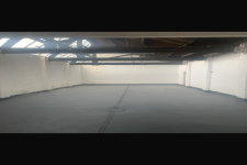
Ace Properties Chartered Surveyors, Lettings & Estate Agents are delighted to present this self contained light industrial unit having a yard area, two production areas and associated stores. Approximate area = 3,610 sq ft (335.38 sqm).

LOCATION

The site can be approached via the main A47 King Richards Road turning right into Fosse Road North. Continue over the traffic light junction of Henley Road and take the second left into Pool Road. Ruby Street can be found off Pool Road.


.

Features

Un-Furnished, Mezzanine

Social Media

Book a Viewing

Floorplan

Contact

Map & Nearby

Inglehurst Infant School
Primary Distance: 0.10 m

Inglehurst Junior School
Primary Distance: 0.10 m

Fosse Primary School
Primary Distance: 0.38 m

Christ The King Catholic Primary School
Primary Distance: 0.40 m

Parks Primary School
Primary Distance: 0.48 m

Stokes Wood Primary School
Primary Distance: 0.53 m

Dovelands Primary School
Primary Distance: 0.62 m

Slater Primary School
Primary Distance: 0.64 m

English Martyrs Catholic School
Secondary Distance: 0.70 m

King Richard Infant and Nursery School
Primary Distance: 0.72 m

Alderman Richard Hallam Primary School
Primary Distance: 0.73 m

Shaftesbury Junior School
Primary Distance: 0.85 m

New College Leicester
Secondary Distance: 0.95 m

Beaumont Leys School
Secondary Distance: 1.01 m

Queensmead Primary Academy
Primary Distance: 1.04 m

Gateway Sixth Form College
College Distance: 1.07 m

Forest Lodge Primary School
Primary Distance: 1.08 m

Imperial Avenue Infant School
Primary Distance: 1.16 m

Fullhurst Community College
Secondary Distance: 1.22 m

Barley Croft Primary School
Primary Distance: 1.24 m

The Hall School
Primary Distance: 1.31 m

Braunstone Community Primary School
Primary Distance: 1.34 m

Babington Community College
Secondary Distance: 1.43 m

Buswells Lodge Primary School
Primary Distance: 1.44 m

Newfoundpool, opp Ruby Street (Hail and ride)
Bus Distance: 0.09 m

Newfoundpool, opp Swannington Road
Bus Distance: 0.14 m

Newfoundpool, adj Swannington Road
Bus Distance: 0.14 m

Newfoundpool, Fosse Road North (E-bound)
Bus Distance: 0.18 m

Newfoundpool, adj Pool Road
Bus Distance: 0.19 m

New Parks, opp Sandhurst Road (Hail and ride)
Bus Distance: 0.20 m

Newfoundpool, Fosse Road North (W-bound)
Bus Distance: 0.20 m

Newfoundpool, opp Pool Road
Bus Distance: 0.20 m

Newfoundpool, o/s Fosse Road North
Bus Distance: 0.20 m

Newfoundpool, opp Beatrice Road
Bus Distance: 0.20 m

Leicester Rail Station
Train Distance: 1.44 m

Birstall, Leicester North (Great Central Railway)
Tube Distance: 2.08 m

Book a valuation